
2009 Tropical Weather Review
2009 was another quiet hurricane season for those with interests along the Eastern and Gulf Coasts of the United States. Below is a short summary of the season worldwide with select HurricaneMapping datasets from the most notable storms of the year to download for use in Goolge Earth and ESRI's ArcGIS. These HurricaneMapping datasets are free for non-commercial use. If you have a commercial use, please contact us.
Links to all available year summaries: 2010 | 2009 | 2008 | 2007
 Atlantic Basin
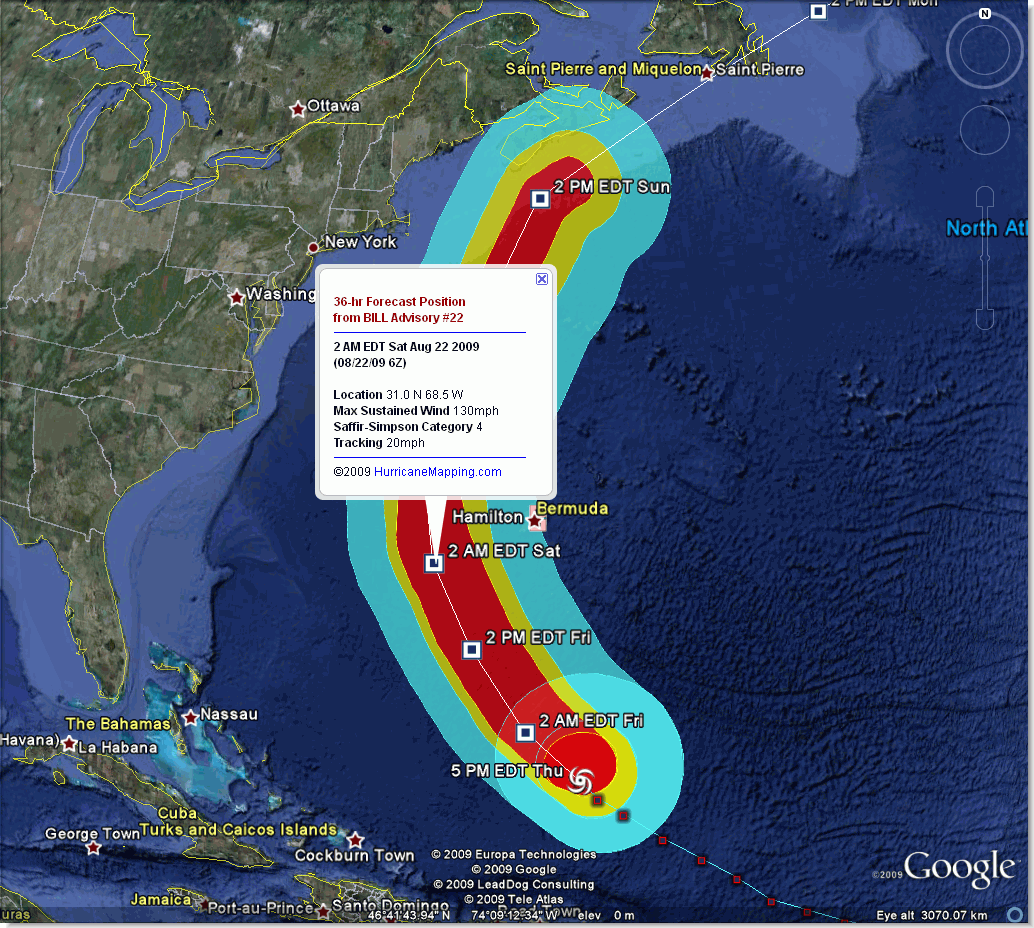
The Atlantic Basin saw the lowest tropical cyclone activity in 12 years. A total of nine named storms formed in in 2009. The most powerful was Hurricane Bill, which generated large swells all along the eastern seaboard. Late season Hurricane Ida produced significant rainfall and extensive flooding after landfall in Alabama.
For a complete picture of the 2009 season, read the National Hurricane Center's Tropical Weather Summary.
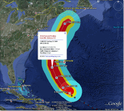
Hurricane Bill Advisory #22 (Thursday, 8/20/09 at 5PM Eastern) as a large category 3 storm approaching Bermuda:
(HurricaneMapping files for this advisory in KML format | Shapefile format)
Hurricane Ida Advisory #27 (Tuesday, 11/10/09 at 9AM Cnetral), at landfall in Alabama as a tropical storm:
(HurricaneMapping files for this advisory in KML format | Shapefile format)
 East and Central Pacific Basins
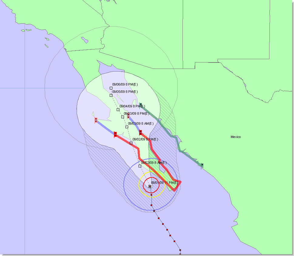
The 2009 Pacific hurricane season was an especially active one. Hurricanes Jimena and Rick were most significant for their intensities and landfalls in Mexico.
Hurricane Jimena Advisory #18 (Tuesday, 9/1/09 at 3AM Zulu) as a category 3 nearing first landfall on the Baja Pennisula:
(HurricaneMapping files for this advisory in KML format | Shapefile format)
Hurricane Rick Advisory #11 (Saturday, 10/17/09 at 3AM Zulu) with the second highest intensity ever recorded for an eastern Pacific hurricane:
(HurricaneMapping files for this advisory in KML format | Shapefile format)
West Pacific, South Pacific, and Indian Ocean Basins
A total of 25 named storms appeared in the West Pacific and North Indian Ocean basins in 2009. Among the notable was Tropical Cyclone Morakot in August, responsible for record-breaking rains in southern Taiwan and landslides in the Philippines.A total of 26 named storms appeared in the southern hemisphere in 2009.
Tropical Cyclone Morakot Advisory #15 (Friday, 10/17/09 at 9AM Zulu) just before crossing over Taiwan:
(HurricaneMapping files for this advisory in KML format | Shapefile format)
_______________________________________________________________
Want more data from HurricaneMapping? Sea Island Software offers affordable subscriptions to KML and Shapefile datafeeds for live storm tracking and access to historic storm advisory datasets. Subscription Plans >>>
Need more information about HurricaneMapping's KML and Shapefile dataset specifications? Refer to the KML Dataset Description and Shapefile Dataset Description pages for details.