
File Formats and Map Layer Specifications
 Shapefile Format for ArcGIS
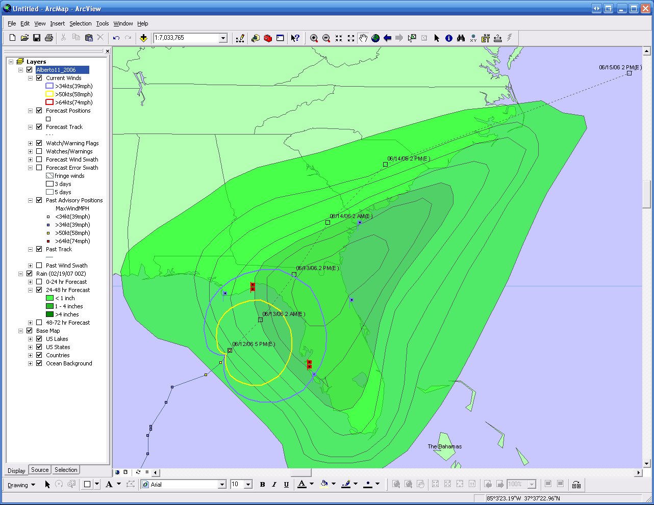
HurricaneMapping's shapefile datasets are optimized for use in ArcGIS 8.2 or later, however you may also find some use in other programs that read the shapefile format. HurricaneMapping's shapefile data is distributed in the form of ZIP files saved directly to your computer. Our Shapefile Manager utility will automate the unzipping process or you can use any zip utility of your choice to extract the data. A single zipped storm advisory package contains SHP, SHX, and DBF files for many map layers. It also contains one or more LYR files that provide instantaneous access to all map layers with logical symbology and labeling already defined.
For details, refer to HurricaneMapping's Shapefile Dataset Description.
You can also download a zipped advisory dataset from Katrina for tryout in ArcMap
 KML Format for Google Earth
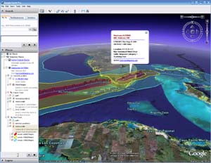
HurricaneMapping KML files are optimized for use within Google Earth version 4.0 or higher. All map layers for an advisory are contained within a single KMZ(zipped KML) file that can be read directly by Google Earth. Presentation-ready symbology, labeling, and other rendering instructions are also built in to the file.
For details, refer to HurricaneMapping's KML File Description.
You can also download a KML advisory dataset from Katrina for tryout in Google Earth
Map Layers
HurricaneMapping's advisory datasets may contain as many as 12 different map layers depending on the conditions of the storm:
- Storm Location - Current location of the eye of the storm at the time of advisory issuance
- Wind Ranges - Extent of tropical storm force, 50kt, and hurricane force winds surrounding the storm center
- Forecast Track - Where the center of the storm in projected to track within a 3 to 5 day period
- Forecast Positions - Storm center locations and forecasted intensity at 12, 24, 36, 48, 72, 96, and 120-hour intervals
- Forecast Wind Swath - A composite of wind ranges throughout a 72-hour forecast period
- Forecast Error Swath - The area in which the storm is most likely to track given forecasting uncertainties
- Past Track - Actual path the storm has taken
- Advisory Positions - Storm center locations and observed intensity at the time of each old advisory
- Past Wind Swath - A composite of observed wind ranges from all advisories
- Watches and Warnings - Hurricane and tropical storm watches and warnings issued for coastlines
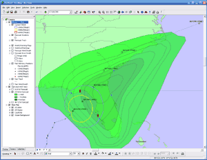
- Rainfall Isopleths (shapefile format only) - Amount of rain expected to fall within a 3-day period
- Flooding Outlook (shapefile format only) - Areas where flooding is possible or likely to occur
- Wind Probabilities (shapefile format only) - 0-120-hour probabilities of tropical storm force, 50kt, and hurricane force winds
Next Page: Subscription Plans for 2009 >>>